May 2
Color and hands on maps!
0 comments
Hands-on geography activity maps kids & teachers

How do you make your map really stand out? Color, of course. See here why the colors you choose are so important.
Coloring is a very important and fun aspect of working on your map.
Colors should match the geographic details of a map when possible. Here are come suggestions:
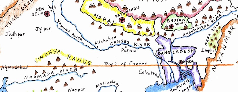
On this detail of our NORTH AMERICA map, we have shown a few ways of using color in different situations.
Shading and coloring a map is a real art. Learn some tips that will make your map easy to read and look great!
When shading an ocean coastline, there are a few ways you can choose from, based on what you like and/or what is easiest for you. The various examples are numbered on the map.
E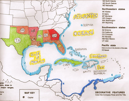 xample 1: Draw a line with light blue parallel to the coastline, then go back and shade it in.
Example 2: Draw a thin dark line in blue along the coastline itself, then shade outwards.
Example 3: Some student cartographers like to draw a shaggy brushstroke type line.
Examples 4 and 5: You can use a thin dark blue line along the coast or a thicker line that extends further out.
Example 6: Use a combination of coloring/shading methods
See examples shown on the map.
To make the labels for oceans and seas stand out, you can use background color behind or around the label.
View all our maps HERE. With these tips in mind, you will be sure to engage your students. Kids LEARN BY DOING– and REMEMBER better when hands on is a tool!


Tags
Session expired
Please log in again. The login page will open in a new tab. After logging in you can close it and return to this page.