No products in the cart.
Hands-on geography activity maps kids & teachers
Hands-On Geography Activity Maps Students Love
Knowing how to read a map helps kids make sense of our world.
Children develop spatial awareness skills using maps.
Geography Activity Maps Students & Teachers Love
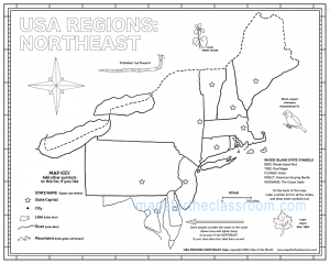
Say goodbye to boring worksheets that are difficult to label, hard to see small details, and end up in the trash as soon as they go home. Our large-format outline maps are designed to help K-12 students make sense of our world, both past and present, through the use of fun activities that:
Teachers love our maps because they support history, math, reading, social studies, and more!

Activity Maps Stimulate a Variety of Learning Styles
Every classroom has a diverse set of learning abilities that demand a teacher's attention. And teachers are being called on to think outside the box to meet these needs. Our 89 maps and classroom tools help today's educators adapt lessons for a wide variety of learning styles including:

Resources to Motivate & Challenge Your Students
Need a fun way to teach American history or world explorer topics? Struggling to liven up your lesson plans? Hands-on activity maps are the answer! Along with the 89 different geography activity maps available, Maps for the Classroom helps busy teachers by providing additional resources that work hand-in-hand with our maps and your curriculum.
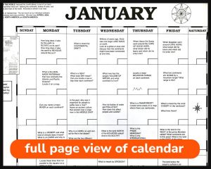
Want to engage your students with a daily geography nugget? Our Question-of-the-Day perpetual calendar is a fantastic conversation starter students really enjoy.
Need supplementary content geared for grades 3-8 that dovetails with all of our maps? The CartoCraze premium membership gives you annual unlimited access to 40+ workshop units that seamlessly integrate with our maps.
Pressed for time? Access 14 free video courses and 8 free downloadable map challenge workshops as time-saving lesson plan helpers inside Earthworm University.
Check out these popular geography resources . . .
Get More Mileage Out of Your Maps With CartoCraze
CartoCraze helps busy teachers maximize student learning opportunities with forever access to more than 40 done-for-you workshops containing over 500 activities geared for grades 3-8 that connect the map you are using to additional related content, extending its use across a variety of studies.
")
Top Reasons Busy Teachers Love Our Maps
Generously Sized
No more squished words and messy papers! Students have plenty of room to locate and label important geographic details, making it easier to visualize where places, cities, and countries are in relation to one another.
Stimulates Creativity
Students love to color and use their imaginations. No two students will write or color the map exactly alike. Each map will be unique to your young cartographers!
Activities Included
Each map comes with activities printed right on the map! Use these or your own lesson plans to connect geography with many other subjects. Plus, you receive bonus geography resources with every purchase.
What Teachers Say

Jensie K.
Teacher
Teacher

Nathalie G.
Teacher
Teacher
Who is Earthworm?
Earthworm has been our mascot from the beginning and he appears on many of our maps and products, helping with the activities. He even has his own Earthworm University with free video courses and downloadable map challenges.
FAST Shipping
friendly service
100% Secure CHECKOUT
About
need help?
contact us
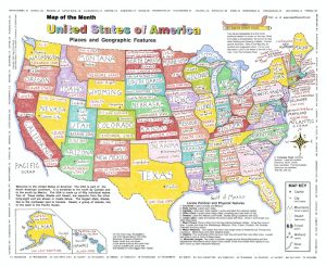
Map of the Month
PO Box 2484, Providence, RI, 02906-0484
Phone: 888-876-6277
Fax: 401-272-7938
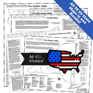
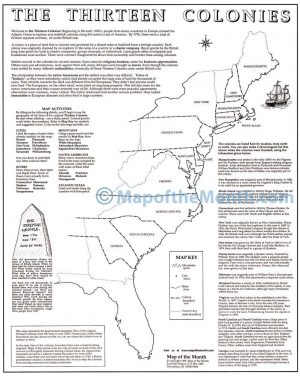
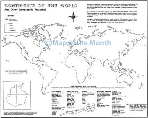
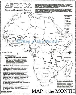
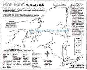
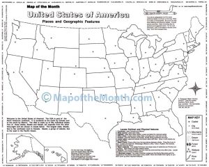
Maps for the Classroom produces 89 hands-on geography outline maps and supplemental geography resources to K-12 schools and educators nationwide. The large 16 x 20 inch size and on-map activities make learning geography fun! Our maps reinforce neatness, encourage research skills, promote teamwork, inspire creativity, and help develop spatial awareness skills.
© Copyright 2024. Map of the Month, Inc., All rights reserved.